|
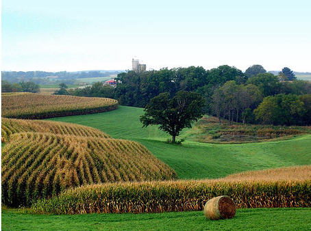
| Contour farming enhances the rolling landscape. |
Pure American Prairie As you slip south of the Great Lakes, traveling west, somewhere in Illinois you all of a sudden realize that the woods are receding and the groves are farther apart. The trees look shorter, the sky looks bigger, and the horizon looks farther away. This Illini prairie wedge is preparing your senses for the "splendor in the grassland" that is Iowa (... apologies to Elia Kazan)!
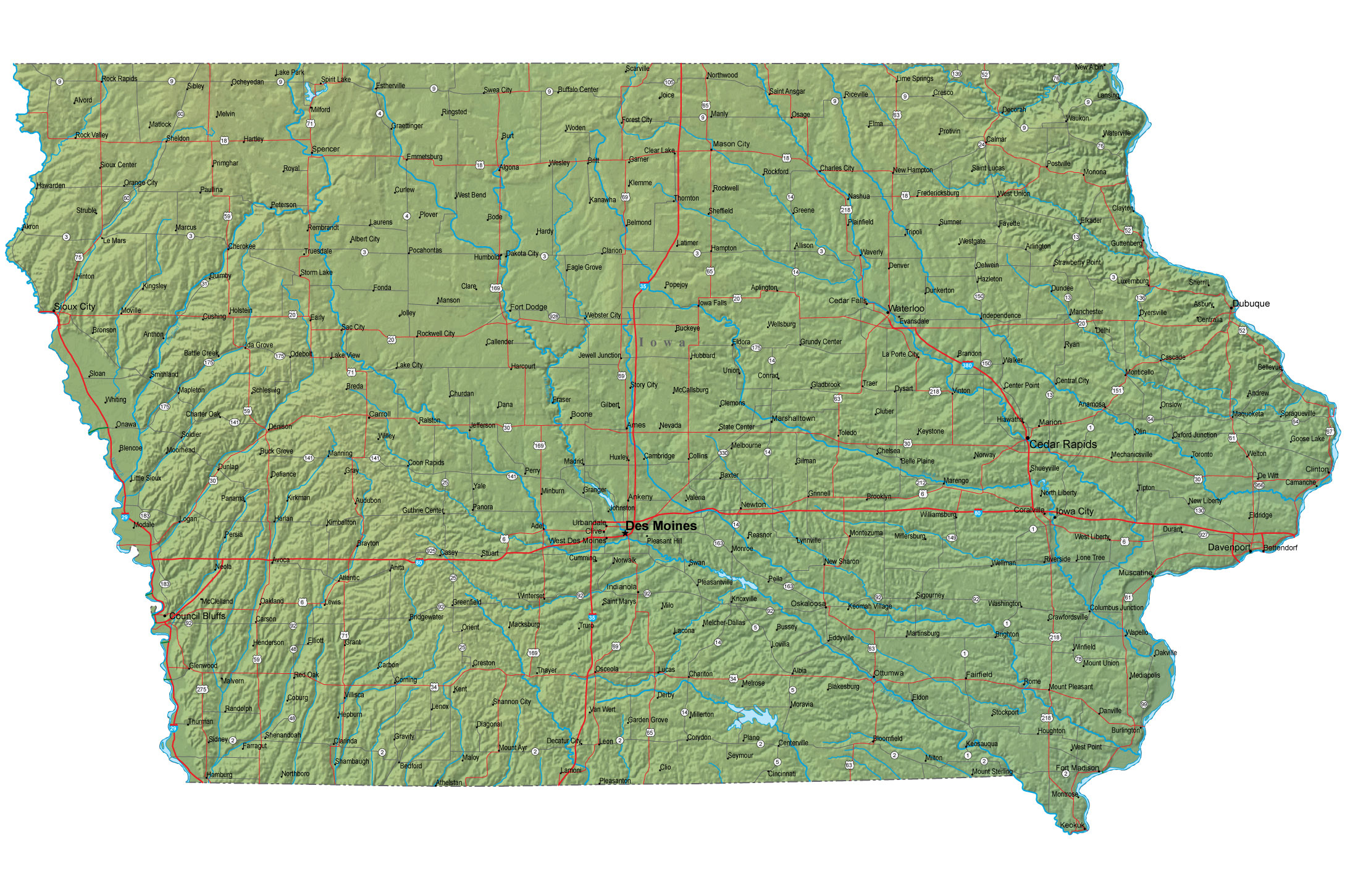
Boundaries defined by the two great Western rivers Iowa looks more like a piece from a jigsaw puzzle than most states. If the states were pieces of a jigsaw puzzle, Iowa's squiggly left and right sides would squeeze between the Missouri and Mississippi rivers, fitting snugly on top of Missouri, and capped by Minnesota. Did you notice that Iowa is bordered by four "m" words?
This breadbasket has fed billions "Rolling prairie, the homesteaders called it. Part of the greatest unbroken, unspoiled expanse of land found anywhere in the world -- that area of this wonderfully new, pure continent that was to become the breadbasket of the world. A land distinguished by the wonderfully rich soil that would feed billions. A land nurtured by its native peoples. Absolutely unspoiled.... One can still see the land as the pioneers saw it. Marvelous. Quiet. Stretching endlessly. Verdant. Grasses swaying in the ever-present wind. Having come from the worn-out lands of Europe, how wonderful this rolling prairie must have seemed to those people of no fear." ~Kent Baker, "A Stroll across Hillside Farm," in
Glimpses: Iowa's Rural Legacy, p. 72.
 |
| 90 percent of Iowa's landscape is devoted to agriculture. Contour farming magnifies the visual impact of a rolling landscape, as this aerial photo from the archives of the USDA Natural Resources Conservation Service shows. |
The greatest story never told Apropos of our Iowa breadbasket, Dumas Malone, the Pulitzer Prize winning biographer of Thomas Jefferson, once told journalist Hugh Sidey, "So much of recorded history is about the struggle of individuals and families to feed themselves. That changed dramatically in this country. The greatness of this country was rooted in the fact that a single farmer could produce an abundance of food the likes of which the world had never seen or imagined and so free the energies of countless others to do other things." It's the greatest story never told, in Hugh Sidey's opinion.
Iowa's changing landscape since the early 1800s The Iowa that Lewis and Clark encountered in their journey up the Missouri River was carpeted by prairie grasses so dense that there was no room for bushes or trees to take advantage of the unbroken soil. Periodic fires swept through the grasslands, keeping bushes and trees at bay. Since the Corps of Discovery went through the region, Iowa's landscape has gone through three overlapping transformations.
- Settlement: In the early 1830s, the territory was opened by Congress for settlement. The surveyors' straight chain was imposed on the rolling landscape. Land rushes resulted in pioneers churning up the tall-grass prairie, transforming the rolling hills into angular croplands. There were few conservation measures, and much rich, black topsoil ended up washing downstream into the Gulf of Mexico, where it found its graveyard in the Mississippi River Delta.
- The New Deal: One hundred years later, the New Deal brought widespread conservation measures to the Hawkeye State. Contour farming became the practice. Rows of trees were planted to act as windbreaks. It's surprising to see how many old trees still grow at the edges of fields. Farmers needed shade from the scorching summers and windbreaks from the freezing winters, as Kent Baker notes [p. 73]. The lack of prairie fires that once swept through the region also allowed the trees to persist.
- Turning silos into smokestacks: The family farm has been disappearing, replaced in recent decades by agribusiness and factories. In Waterloo, for example, you can see John Deere tractors being assembled. John Deere, the world’s leading manufacturer of agricultural tractors, is the sole tractor manufacturing plant left in the world that retains its founder’s name.
 |
| Native Iowan Henry A. Wallace |
Henry A. Wallace This native son of Adair County took his degree from Iowa State University, where he was trained as a plant scientist. In rapid succession he served as FDR's secretary of agriculture, secretary of commerce, and second vice president -- before running for president in his own right in 1948. Words associated with the Secretary of Agriculture (from an Iowa monument to their native son): prairie restoration, terracing, contours, erosion control, soil restitution, crop rotation, single-cross hybrid seed, farm ponds, woodland restoration, first U.S. Soil Conservation District.
Big tractors, corn, soybeans, hay -- that's Iowa, which bills itself the "Food Capital of the World." It's the kind of place where, if you spend any time there, you should know the difference between a John Deere A and a John Deere B.
 |
| At the edge of a rural neighborhood. |
Transformation of farms If you talk to people whose families have farmed in Iowa a long time, you learn that two twentieth-century developments made all the difference in rural America: technologically, tractors replaced horses by the end of World War II, bringing much more power to farming; genetically, hybrids replaced older plants, producing superior crops that could grow through disease, drought, and grasshoppers. ~Neil E. Harl, Introduction,
Glimpses, pp. 7-8.
Neighboring skills Iowa is the kind of place where a lot of people live in identifiable rural neighborhoods. (Think about that word -- an area where people know each other by name and sight and are often "neighborly.") Traditionally at the center of an Iowan rural neighborhood were two institutions: a one-room schoolhouse and a church. A 4-H club might meet nearby. Rural sociologists, studying the cooperative nature of these remote neighborhoods, have observed the "little platoons" people form to help one another. But in recent decades the decline of "neighboring skills" has been noticeable. ~Jack Van Laar, "Maple Grove -- A Rural Neighborhood," in
Glimpses, pp. 13-16.
Land of rural towns People justifiably think of Iowa as an agricultural state. Yet, improbably, Iowa lays claim to 950 towns and small cities -- more than any state but Texas. [LaVon Griffieon, "Let's Keep the 'I' in Iowa," in
Glimpses, p. 118.] I don't believe it. As I travel I-80, the nation's greatest, most historic, east-west transportation corridor, I just don't see that many towns.
 |
| In the case of I-80, the kitsch is countered by a historic transportation corridor that follows the journey of the American Dream into the West. The Mormon Handcart Trail was blazed across Iowa near I-80, and it approximates the later Lincoln Highway, the nation's first coast-to-coast road. West of the Missouri River, I-80 approximates the Oregon and California trails, and is associated with the first Transcontinental Railroad. |
I-80 It is fashionable to blast travel by interstate as kitschy, soul-sucking monotony. But the Interstate-80 corridor, connecting New York and San Francisco via Chicagoland, is one of the great conduits through which our nation's history has pulsed. America's second-longest interstate highway, I-80 most closely approximates the route of the historic Lincoln Highway, the first road across America; and it roughly traces other historically significant travel routes into the West: the Oregon Trail, California Trail, Mormon Trail, Pony Express, and first Transcontinental Railroad.
Cities According to the U.S. Census Bureau, in 2010 the United States had 275 cities with a population of more than 100,000 people. Iowa has only two cities that make the list: Des Moines is ranked 106th with 203,000 people; and Cedar Rapids is 196th with 126,000 people.
 |
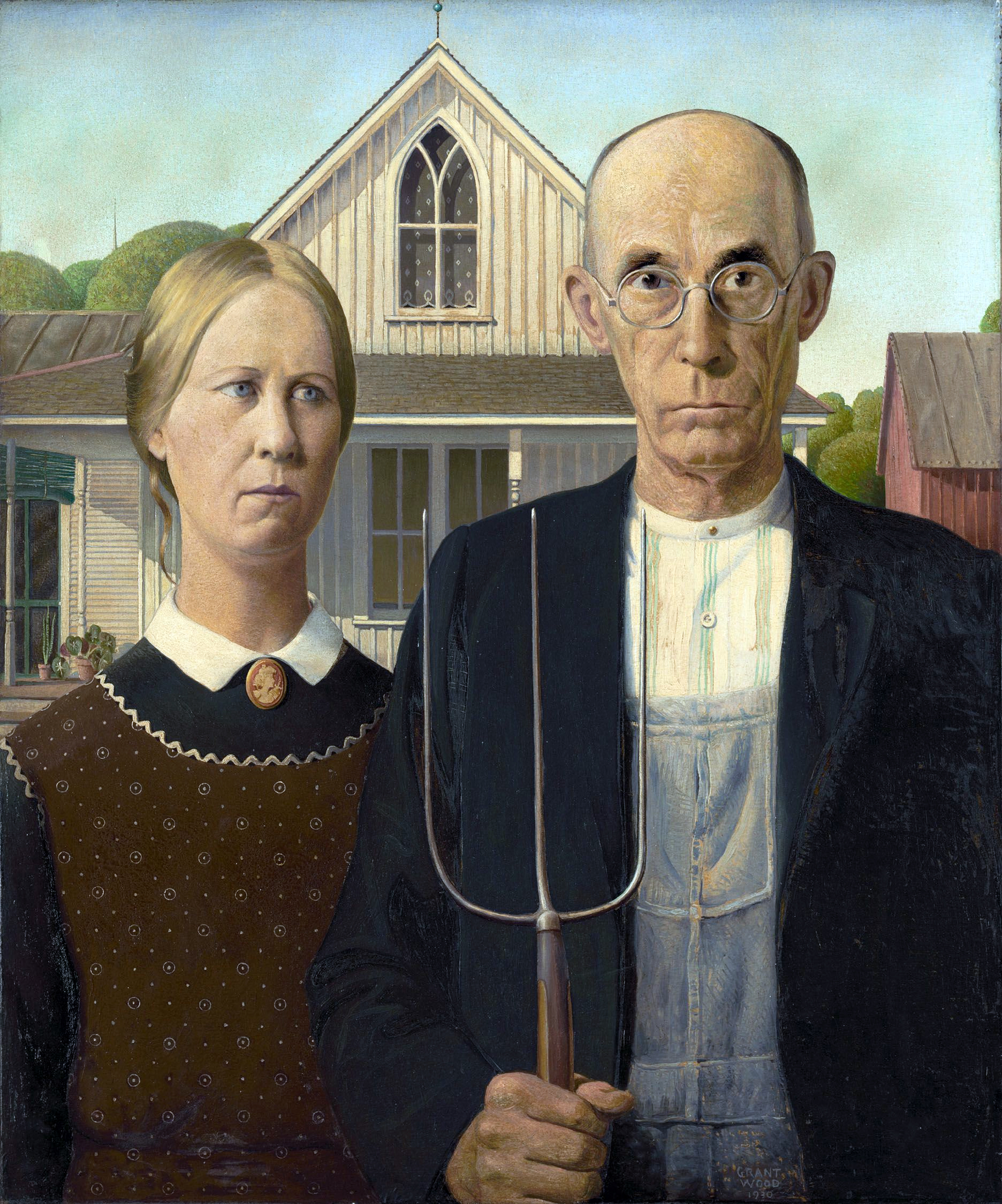
| Iconic Iowa: Grant Wood, American Gothic, 1930 |
American Gothic Speaking of which, Cedar Rapids is famous for the most iconic work of art ever associated with Iowa. Grant Wood's
American Gothic, one of the most parodied paintings of the 20th century, was created in 1930. A product of the Great Depression,
American Gothic depicts an Iowa father and his daughter (modeled after Wood's dentist and sister) expressing grim determination to get through hard times. Many modernist critics believed the painting's "deeper" meaning amounted to a satire of the Midwest's provincial lifeways, but apparently Wood was not aiming at social criticism. You can decide for yourself if you go to the Art Institute of Chicago to see the painting.
Hawkeyes The logo on Iowa football helmets is called the Tigerhawk. The mascot is named "Herky the Hawk." Both are traditions that developed after World War II. But the nickname "Hawkeye" was actually coined in the 1830s
to commemorate Chief Black Hawk of Black Hawk War fame.
Pie shakes An Iowa original. Can't miss 'em!
Iowa's Loess Hills present some of the best loess (windblown silt) topography in the world. You can see picturesque landforms carved out of loess on the western rim of the state above the Missouri River floodplain in places like Council Bluffs and Sioux City. (Again, the Plains are not flat!) Abraham Lincoln ascended Council Bluffs to inspect a potential site for the eastern terminus of the transcontinental railroad. And Sargeant Charles Floyd, the only fatality in Lewis and Clark's Corps of Discovery, was buried in the Loess Hills above Sioux City. The silty deposits came about during the Pleistocene, when continental glaciers ground down rocks to the consistency of flour. When the glaciers retreated and the vast meltwater lakes receded, winds blew the floury silt that had lined the lakebeds into dunes mostly on the east side of the Missouri River floodplain. In many places, the silt deposits are more than 90 feet thick, and erosion has sculpted the loess into fantastic ridges.
 |
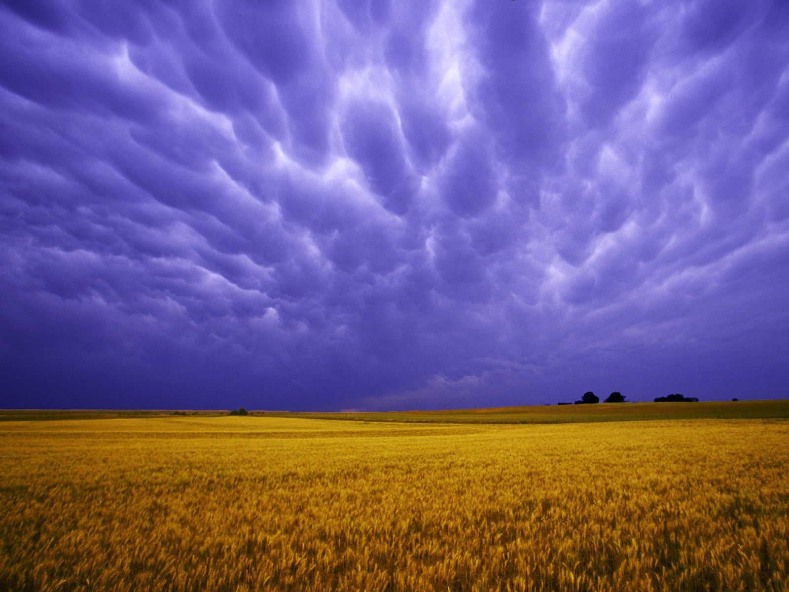
| Splendor in the Grassland |
Iowa in August County fairs, butter cows, bikers on their way to Sturgis (South Dakota), and the quadrennial straw poll mark the waning days of summer in the Hawkeye state.
* * *
Bibliography Iowans have great pride in their landscape, which is one of the reasons I enjoy visiting the Hawkeye State. Two gems edited by Robert F. Sayre include,
Take This Exit: Rediscovering the Iowa Landscape (Ames: Iowa State University Press, 1989); and
Take the Next Exit: New Views of the Iowa Landscape (Ames: Iowa State University Press, 2000).
Another little gem I found, on the Mississippi River overlook near the Quad Cities, is
Glimpses: Iowa's Rural Legacy (Ames: Iowa Farm Business Association, 2004).