Thursday, June 30, 2011

Geography, the joy of place

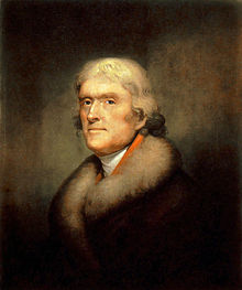
Garden of Eden, by Thomas Cole
An offbeat definition: Geography is more than an academic discipline. A geographic presence of mind disciplines you to live in the present, and to know and enjoy the place where you are. It is thus the source of happiness -- hence the notion of geography instilling the "joy of place." This awareness of place, this awakening to place, is very Buddhist. To be alive to place is the source of great happiness.

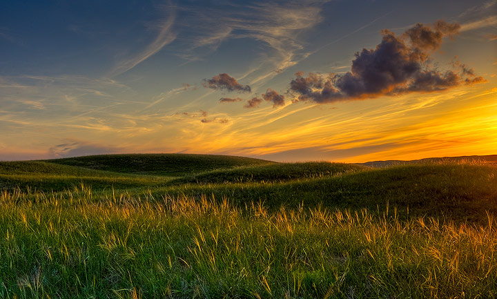
Humans have the primordial urge to return to Eden, so they try to see glimpses of Paradise everywhere they are. Beautiful landscapes are a vestibule of the Heaven that awaits them. They thus sanctify place and redeem time. The discipline of geography is a way of "finding" God, not in place, but through place. This primordial urge to return to Eden, to our original home, is very Jewish. To see unexpected beauty in a place -- for example, in a brilliant sunset -- is another source of happiness.

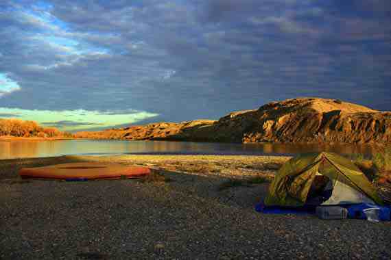
There is often the desire to strike out into the unknown, yet with the confidence that, if we follow the rules of the road, it will lead to a better place, one we've not been to before. Fixing our compass on a better place in the future is a very Christian aspiration. This hope in a better place in the future is another source of happiness.


I. Journeying ... and the joy of geography
A great tradition of literature of travel, sojourneying, combines the joy of geography with the joy of words: Homer's Odyssey, Chaucer's Canterbury Tales, Dante's Divine Comedy, Steinbeck's Travels with Charlie, Pirsig's Zen and the Art of Motorcycle Maintenance, William Least Heat Moon's Blue Highways)

Robert Pirsig in Zen and the Art of Motorcycle Maintenance (pp. 1-2):

"We are in an area of the Central Plains ... heading northwest from Minneapolis toward the Dakotas. This highway is an old concrete two-laner that hasn’t had much traffic since a four-laner went in parallel to it several years ago.... I’m happy to be riding back into this country. It is a kind of nowhere, famous for nothing at all and has an appeal because of just that.
Tensions disappear along old roads like this.... Chris and I are traveling to Montana with some friends riding up ahead, and maybe headed farther than that. Plans are deliberately
indefinite, more to travel than to arrive anywhere. We are just vacationing. Secondary roads are preferred. Paved county roads are the best, state highways are next. Freeways are the worst. We want to make good time, but for us now this is measured with emphasis on 'good' rather than 'time' and when you make that shift in emphasis the whole approach changes."


II. Geographical awareness heightens one's sense of irony, and irony can be a source of joy, producing a wry smile. Geographic irony includes:

Mouth of a river emptying into the Indian Ocean in Mkambati Nature Reserve, Pondoland, South Africa

1. The notion of the "mouth" of a river. It is a bad analogy to the human mouth because it gets it all backwards. We usually associate the mouth with the nourishment that is taken in. But the mouth of a river relentlessly discharges its watery nourishment from its "alimentary canal" -- its system of tributaries -- to an estuary that feeds land and marine life.
The Father of Cool: Willis Haviland Carrier
2. Modern air conditioning. Coolness was invented in the Northeast. Yet it made possible the flight from the region of its birth to the South and West. Houston, Dallas, Atlanta, Phoenix, San Antonio -- these megalopolises would never have grown so large without the New Yorker's invention. The modern air conditioning system that Willis Haviland Carrier (November 26, 1876 – October 7, 1950) invented in Buffalo, New York, on July 17, 1902, in response to a quality problem experienced at the Sackett-Wilhelms Lithographing & Publishing Company of Brooklyn, marked the birth of air conditioning because of the addition of humidity control, which led to the recognition by authorities in the field that air conditioning must perform four basic functions: (1) control temperature, (2) control humidity, (3) control air circulation and ventilation, and (4) cleanse the air.

The United States in the 1860s, during the Civil War
3. The "West" was not so west prior to and during the Civil War. Culturally it was loaded with meaning that had been imported from the North and South. Remarkably, both Abraham Lincoln and Jefferson Davis were born in the western state of Kentucky, less than 50 miles from one another. Missouri had the third most battles of any state involved in the Civil War (after Virginia and Tennessee). Farther west still, Bleeding Kansas was the dress rehearsal for America's bloodiest war. The Civil War was entangled in the question over the expansion of slavery into the West much more than many Americans realize.


American geography combines with American history and politics to equip our minds to deal with complexity, and untangling complexity can be a source of joy:


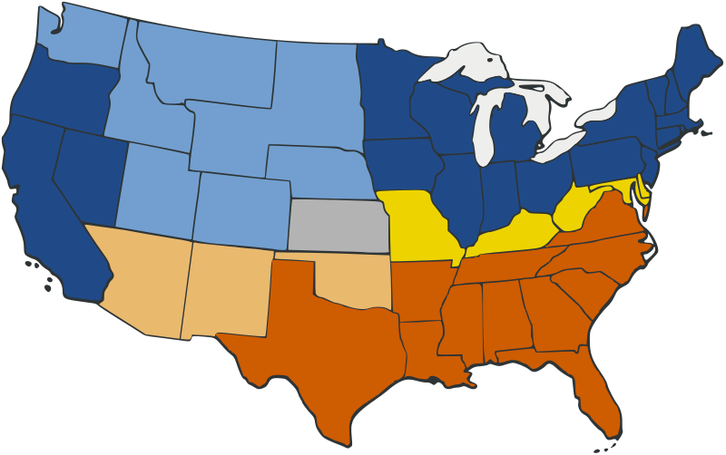
The joy of complexity: Illinois
 So many places are more complex and interesting than we’ve been taught in school. We take it for granted that a state like California is diverse physically and culturally. But Illinois? It is called the “Prairie State,” whose landscape is often regarded as boring by people zipping across I-80. It is anything but. Waterfalls in the cliffs and rock outcrops above the Illinois River; high bluffs overlooking the Mississippi; hummocky karst landscape around Carbondale -- a little digging and you discover that Illinois is much more than a prairie. True, the Illini prairie peninsula intrudes from the west. But the diverse botany of the state inspired a University of Chicago scholar, Henry Cowles, to pioneer the development of ecology in the 1890s with his studies of plant succession.
  • Geologically, the state's foundation rocks vary from those of the Great Lakes Basin to those of the Gulf Coastal Plain.
  • Geomorphologically, glaciated in the northeast, with moraines, but unglaciated in the northwest, in the driftless area.
  • Ecologically, oak-hickory forests in the north, bald cypress in the south.
  • These physical southern connections are reinforced by a host of other southern links.  LaSalle unites the area to Louisiana in the contest for empire.
  • The Mason-Dixon Line splits the state in two – the line is just five miles south of the state capitol building in Springfield.
  • Illinois is regarded, properly, as a northern state. It was a free state that remained in the Union during the Civil War. After all, it is the “Land of Lincoln,” and Ulysses Grant called it home. Yet the southern third of the state has a southern feel and people speak with a southern accent because immigrants came in from Kentucky, across the Ohio River to the east. 
  • Illinois -- considered "western" in the early 1860s -- was important as a Civil War staging area at Fort Defiance
  • Chicago (big, new, modern) and Cahokia (relatively big, ancient, extinct) and places in between that cling to existence, places like Cairo (whose hopes have been dashed, but see the SIU proposal).


Tuesday, June 28, 2011

Great Plains geography 5

The High Plains, where they have escaped the bulldozing effect of continental glaciers, are hardly flat, as this rolling landscape in South Dakota shows.
As I drive from east to west on I-70 from Missouri into western Kansas, or on I-80 from Iowa into western Nebraska, or on I-90 from Minnesota into western South Dakota, here are some three-dozen things that I observe as the road leaves the scattered forests and tall-grass prairie of the Midwest and stretches into the High Plains:
  • Because short grasses replace tall grasses and trees, the horizon seems to stretch farther and farther away.
  • The 360-degree horizon is flat, but the middle ground and foreground are not necessarily so. In South Dakota, for example, north and east of the Missouri River, much of the land has been planed by continental glaciers and is thus flat. South and west of the Missouri River, the land escaped continental glaciation and therefore can be quite rolling. Some think the velvety hummocky landscape looks like a great golf course. The same could be said for the Flint Hills and Smokey Hills of Kansas, and the Sand Hills of Nebraska.
  • Periodically, one encounters fantastic geologic formations like Nebraska's Chimney Rock, or Colorado's Pawnee Buttes, or North and South Dakota's Badlands. These whimsical landforms break the monotony of an otherwise expressionless horizon.
  • 
    James Nedresky's photographs capture the land best.
    
  • There are a surprising number of prairie ponds, sometimes lined with rushes and cattails, sometimes not.
  • In the summer heat you can conjure larger and larger mirages on the highway up ahead.
  • Exits are farther apart; there are more signs warning drivers, "Next Exit __ Miles"
  • At the higher elevations, the August air smells sweeter.
  • My nose and lips begin to crack in the thinner, drier air.
  • The atmosphere is clearer, so I can see the outline of clouds at an impossibly far distance -- more than 100 miles away.
  • In an afternoon summer shower, the sun is apt to shine during a brief cloudburst.
  • Because of blizzards, there are barricades at the on-ramps of highways and in some places across the lanes (e.g., on I-80 at Mile 238 between North Platte and Kearny).
  • Because of drifting snow, there are long stretches of snow fences.
  • There are more signs announcing the conservation district one is in.
  • There seem to be as many John Deere dealerships as car dealerships.
  • In August, the corn becomes noticeably shorter.
  • You can see lots of crop dusters -- often biplanes -- flying low over the corn.
  • There are more center pivot irrigation systems, especially for corn and sugar beets.
  • Wheat and sunflowers replace corn and soybeans as the miles mount. Usually it's winter wheat.
  • Trees are limited to bottomlands and windbreaks around houses and fields. Cottonwoods line streams. There is an occasional Russian olive.
  • There are more and longer barbed-wire fences.
  • There are more windmills of the old-fashioned kind. Nowadays there are huge wind-harvesting machines, and big trucks carry the propellers along interstate highways as "oversized loads."
  • There are more pickups and more drivers wearing cowboy hats. 
  • There are more cowboys and references to cowboys in billboards.
  • There are more saddlery shops.
  • There is a higher percentage of Indian names.
  • There are more black angus cattle and some red angus cattle, too.
  • There are more feedlots.
  • You see more corrals with pretty horses in them.
  • Museums are more apt to display the long-barreled Colt 45.
  • Towns become like tree islands amid a sea of grass. One can make out the boundaries of the town from a fair distance. The skyline provides welcome vertical relief from the unending horizon. Towering over the town are a great white grain elevator, silver silos, a water tower or two, and perhaps a church steeple.
  • You can see long black trains in the distance, usually carrying coal.
  • And there is only one place in the world where you can see all the billboards announcing the approach of Wall Drug Store! 

You can infer a lot from what you observe as you head west. For instance:
  • The greater number of billboards sporting gun and ammo ads tell you that this is Second Amendment country. Don't even think about interfering with the libertarian spirit out West.
  • The homesteads are often far from surface water. Geologically this suggests the existence of great aquifers; legally it suggests the doctrine of prior appropriation of water rights.
  • The tourist tee-pees you see by the side of the road echo the time when they were the indigenous shelter of Plains Indians, who made them from buffalo hides.
Tee-pees made from buffalo hides were the indigenous shelter of High Plains Indians.


What have I failed to observe or forgotten to note?

buffalo in South Dakota


Sunday, June 26, 2011

Great Plains geography 4

The loneliness of the land: Rick Dunn's photograph of the Pawnee Buttes, east of Fort Collins, Colorado. Although Colorado is regarded as the Rocky Mountain state, almost half of it extends into the Great Plains. (See Rick Dunn's essay that accompanies this photo.)

The best synonyms for the "Great Plains" are "High Plains" and "western sea of grass." James Fenimore Cooper referred to the region as "the Great Prairies west of the Mississippi" [The Last of the Mohicans, 1826, Introduction]. Other synonyms are sometimes used in popular parlance but they don't work well:

Misleading characterization 1: Great Plains = Great American Desert
The Great Plains go through periodic droughts that seem to turn the region into a wasteland. West Texas is experiencing such a drought as I write. [See article here.] But humans have also contributed to the catastrophes of the last 150 years, especially because of the over-extension of grazing and of deep plowing. As a result, ordinary drought cycles such as occurred in the second half of the 19th century were magnified during the first half of the twentieth century. One catastrophe was the so-called Dust Bowl. Such catastrophes are relatively rare. In most years since Anglo-American encroachment, the Great Plains have received adequate rainfall during the growing season to support a harvest of wheat. The eastern part of the region is wetter, an ecological garden, a veritable breadbasket. So where did the term, "Great American Desert," come from? In 1819 President James Monroe sent an American explorer named Stephen Long to explore the west. He trekked through the Great Plains in a dry spell and believed the land was inhospitable, and so labeled the region west of the 98th Meridian the Great American Desert. The moniker lasted from the 1820s to the 1870s. It's another way an early president of our nation had a surprising impact, this time on the perception of the Great Plains.

Major Stephen Long's 1820 map of the "Great American Desert." The Great Plains comprise the easternmost third of the arid Great American Desert and Great Basin.

Dust Bowl


Misleading characterization 2: Great Plains = the prairie
It would be more accurate to say that the Great Plains = shortgrass prairie. As the map below shows, the vast prairies of North America are not coterminous with the Great Plains but extend considerably to the east of the region. At the time of Columbus, the famous "prairie wedge" speared east of the Mississippi River into Illinois. In addition, there were numerous prairies islands east of the Mississippi River. But Illinois's prairie wedge and the prairie islands farther east should not be considered High Plains. Note on the map below the curious extent of prairie in Michigan, where tallgrass prairies thrived in glacially deposited, sandy, outwash plains in Newago County where the Muskegon River flows. Eventually it morphed into the so-called Big Prairie Desert because of the extent of sand and sparce vegetation. It is misleadingly regarded as the largest "desert" east of the Mississippi River.

Extent of indigenous shortgrass prairie (light green), mixed prairie grasses, and tallgrass prairie (dark green) at the time of Europeans' arrival in the Americas. A safe generalization is that the eastern extent of the Great Plains began where the tallgrass prairie ended. The climate is wetter where the tallgrass prairie thrives, and drier where the shortgrass prairie grows.


Misleading characterization 3: Great Plains = Tornado Alley
Children who see the classic, The Wizard of Oz, know Kansas has killer tornadoes. Among Great Plains states, Oklahoma is even more torn up by twisters than Kansas is. But the farther north and west one travels on the High Plains, the more rare tornadoes are. Indeed, the northern Great Plains are one of the safer places to live east of the Rockies if you are lilapsophobic.


The U.S. has at least four Tornado Alleys. The one on the Great Plains goes from north-south -- down through Nebraska, Kansas, Oklahoma, and Texas. An even deadlier alley straddles the Deep South -- extending east-west across Alabama, Mississippi, Tennessee, Arkansas, Louisiana, and Oklahoma. Note that the Great Plains state of Oklahoma is the junction of these deadly Tornado Alleys. But the farther north one goes on the High Plains, the rarer tornadoes are. Boston, Massachusetts, has far more tornadoes than Billings, Montana.  


There are far more night twisters in the Deep South's Tornado Alley than in the Great Plains' Tornado Alley.


Misleading characterization 4: Great Plains = Corn Belt
Although the Corn Palace is in Mitchell, South Dakota, corn only thrives in the bottomlands and irrigated tracts of the High Plains. True, the eastern part of the Great Plains has the climate, soil, and water to grow robust harvests of corn. Yet the High Plains are better known for spring and winter wheat. They are really part of the wheat belt because wheat can withstand arid conditions better than corn can. And because wheat grows here, there are cattle -- lots of cattle. Great Plains wheat sustained the long cattle drives after the Civil War. Not many people know that Theodore Roosevelt spent time as a cattleman on the Great Plains. Retreating from civilization after the deaths of his wife and mother on Valentine's Day, 1884, TR resigned from the New York Assembly and went to Dakota Territory where he invested in two ranches and worked as a cowboy.
Corn grows well in the eastern parts of the Great Plains, as well as in the bottomlands of the High Plains, but the region is better known for wheat and the cattle fattened by it.


Misleading characterization 5: Great Plains = Midwest
For the practical needs of the classroom, teachers break down the Continental U.S. into manageable chunks of states. Somewhat arbitrarily, they have drawn a line around a bloc of 12 states in the north-central part of the nation -- from Ohio and Michigan in the east to Kansas and North Dakota in the west -- and labeled them "the Midwest." Only four of the Great Plains states are technically in the Midwest: North Dakota, South Dakota, Nebraska, and Kansas. Even these states have more of a western than a midwestern feel, what with their rodeos and rangeland the closer one gets to the Rockies. The High Plains also extend into three states of the Southwest -- Texas, Oklahoma, and New Mexico -- as well into three states of the Mountain West: Colorado, Wyoming, and Montana. So the Great Plains stretch across three somewhat artificially designated regions. Depending on the place, one can feel the tug of the Midwest, West, and Southwest in the grasslands.

From the perspective of elementary geography textbooks, the Great Plains spread across three major geographic provinces. The Great Plains include the westernmost states of the Midwest (in red) -- North Dakota, South Dakota, Nebraska, and Kansas. This western sea of grass also stretches into parts of the Southwest and Mountain West.

*     *     *

SOURCES

For the Internet source of each photograph, map, and illustration used in this essay, click on the image.

Additional sources that I consulted are available through the hyperlinks in the text, or below.

For a bibliography of Great Plains geography, consult http://libguides.emporia.edu/content.php?pid=60124

Oklahoma is discussed at http://digital.library.okstate.edu/encyclopedia/entries/G/GR015.html


Theodore Roosevelt, cowboy
"I never would have been president if it had not been for my experiences in North Dakota."
*     *     *

This photo-essay is part of a series on Great Plains geography.

Saturday, June 25, 2011

Great Plains geography 3

The High Plains: You know 'em when you see 'em.

Comparing the seven maps that follow shows the challenge of defining the Great Plains. The first map is the most vague; the last map, the most specific. Nevertheless, each map locates the region's boundaries differently, especially its soft eastern margin that merges into the lower Central Plains and tall grass prairie.

The Interior Plains, which make up half of the Continental U.S., are divided into two parts: the Central Plains/Lowlands to the east and the Great Plains to the west. The boundary between the two parts is not distinct. But this summation holds true: The Central Lowlands' rich soils have made the region famous as America's breadbasket; the Great Plains' sea of grass became legendary for trail drives, ranches, and the cowboy cattle empire. Also the Great Plains are considerably higher in elevation than the Central Lowlands. Viewed from the Mississippi River Valley at, say, St. Louis, the plains are a plateau of sedimentary rock that rises gently west to the foothills of the Rocky Mountains. At Denver, Colorado, the land is one mile high.   


This depiction of the Great Plains shows a huge rural expanse covering almost one-forth of the Continental U.S. Lying astride the 100th meridian, the Great Plains extend over all or parts of ten states west of the Mississippi River and are part of the vast Interior Plains physiographic province.


Indigenous grassland biomes on the Great Plains include the steppe-like short grass prairie (light green) and mixed grasses between the 100th and 98th parallels. The tall grass prairie to the east (dark green) is often used to distinguish the eastern boundary of the Great Plains from the Central Lowlands. However, there are hardly any remnants of tall grass prairie left.
Another map of the North American prairie. The short grass prairie is in yellow.


Geomorphically, the Great Plains are much more complex than most Americans realize.
Visit the U.S.G.S. site http://tapestry.usgs.gov/physiogr/physio.html for a remarkable topographic map of and map key to the physiographic regions of the United States. Geologically, the High Plains, as the term suggests, are composed of numerous layers of relatively horizontal sedimentary rock that slopes gently east from the Rockies toward the Missouri-Mississippi rivers. But erosion has produced complex terrain (geomorphology), especially near larger rivers. Among the landforms on the High Plains are plateaus, mesas, buttes, hogbacks, bluffs, badlands, loess formations, moraines left by continental glaciers, and driftless plains that largely escaped glaciation. Depending on where one puts the boundaries of the region, elevations range from 7,000 feet in Colorado (the Black Forest) to under 1,000 feet in North Dakota (along the Red River) and Texas (Edwards Plateau).


This map of the grasses, crops, and other vegetation of the Great Plains extends farther east than the geologic and most geographic depictions of the Great Plains; the coniferous patch in South Dakota represents the Black Hills. Note that the region's boundaries, viewed from the perspective of agriculture and land use, extend into Mexico and Canada.


A consortium of scholars at the University of Michigan, Colorado State University, and University of Saskatchewan has defined the eastern boundary of the Great Plains with a concession: "The only agreement on this boundary is that no authoritative line exists. Numerous people have attempted to define this border in both physiographical and cultural terms, using such demarcators as the 100th, 98th, 95th, and 88th meridians; the Missouri, Arkansas, and Mississippi rivers; and various levels of annual rainfall. Our boundaries depend on a combination of climatic, topographical, political, and cartographic criteria, and are ultimately drawn along county borders. According to these definitions, the Great Plains region contains about 475 counties in twelve states."

As land use maps suggest, the Great Plains have the lowest population density east of the Rockies; in many places fewer than 2 inhabitants per square mile live there. One keenly experiences the loneliness of the land in eastern Montana, eastern Wyoming, and the western Dakotas in the U.S., and great stretches of Alberta and Saskatchewan in Canada. Their rural feel contrasts with significant cities around the perimeter of the Great Plains that serve as the region's entrepots: Fort Worth, Oklahoma City, Tulsa, Kansas City, Omaha, Sioux Falls, Fargo, Winnipeg, Saskatoon, Edmonton, Calgary, Cheyenne, Fort Collins, Greeley, Boulder, Denver, Colorado Springs, Pueblo, San Antonio, Austin, and Waco. There are also significant cities within the Great Plains, but on average they are smaller than the perimeter cities. The interior cities include Moose Jaw, Regina, Billings, Minot, Bismarck, Rapid City, Pierre, Lincoln, Wichita, Abilene (Kansas), Topeka, Amarillo, Lubbock, Midland, Odessa, Abilene (Texas), and Roswell.


*     *     *

This photo-essay is part of a series on Great Plains geography.

Friday, June 24, 2011

Great Plains geography 2

Jefferson & Trains

In a land whose reference is the horizon, it is difficult to grasp dimensions. These western grasslands, no respecter of the longest international boundary in the world, extend north into Canada's Prairie Provinces. If you were to drive from southwest Texas to north Alberta, you would cover some 2,400 miles and never have left the Great Plains. If you were to travel from the eastern Dakotas to the Montana Rockies, you'd journey some 700 miles and never have left the Great Plains.

Jefferson anticipated western land rushes.
 The township & range aided surveyors
and expedited property claims.
Because the region was settled by Anglo-Americans after the Civil War, it boggles the mind that one of America's founding fathers would have a lasting impact on the landscape of the Great Plains. But Thomas Jefferson's imposition of the township-and-range survey system -- first on the Old Northwest, then by extension on the Louisiana Purchase -- became the measure of the West. It was the most expeditious way for surveyors to deal with land rushes. From the air, you can see the rectangular layout -- mile after mile of straight rural roads going north-south or east-west -- Etch-a-Sketch lines, as Alicia Rebensdorf puts it. It makes for a seemingly endless checkerboard. As a result, most of the boundaries of the states and provinces in the Great Plains have no correspondence to physical features like rivers, watersheds, or continental divides. Rather, their boundaries are straight-line parallels and meridians. Colorado and Wyoming in the U.S., and Saskatchewan in Canada, are entirely creatures of parallels and meridians. The same holds for many county boundaries in the region. (By the way, Utah is the only other state or province whose boundaries are solely parallels and meridians.)

Railroads, east-west "streams of steel" that replaced river transport, had a great influence on settlement patterns and even the shapes of Great Plains states.


Consistent with the Jeffersonian grid imposed on the Louisiana Purchase, most Great Plains states are rectangles that are elongated on an east-west axis. Why elongated? The answer lies in the development of a dramatic new mode of transportation that took off in the middle of the 19th century, railroads. Linking far-away markets between the Atlantic and Pacific, continental railroads replaced waterways in the arid West as the most expeditious way to move people and goods across the land. The Pacific Railroad Act of 1862 kick-started the laying of rails and dreams of new settlements. Kansas, Nebraska, South Dakota, and North Dakota are each 3 degrees latitude "high" and approximately 7 degrees longitude "wide" because of the east-west movement of people and goods on this sinuous stream of steel.

Most of the states in the Great Plains, moreover, cover a similar extent of land. Why? It goes back to Jefferson's idea of equality regarding national expansion. The new states were to be equal republics not just politically but also geographically. In the world's first great republic, western states would not be colonies dependent on the older states in the East or Midwest.

Given the region's size and diversity, even a bevy of specialists with Ph.D.'s cannot do the landscape justice. Consider all the ways the various disciplines attempt to describe, define, circumscribe, and manage the Great Plains:

The township & range grid --
Jefferson's lasting legacy to the region.


  • Geographers shoehorn the Great Plains into the westernmost physiographic province of North America's interior plains. A rural hinterland, the plains slope east from the foothills of the Rockies toward the Mississippi River. This great expanse of plateau is carpeted with prairie grasses and filled with an array of cultural and natural surprises -- like the fact that a continental divide cuts across the land, separating the watershed of Hudson Bay from that of the Gulf of Mexico. The basic land-use pattern of the land is the square grid -- township and range -- established by Thomas Jefferson to deal judiciously and expeditiously with land rushes.
  • Geologists chisel into its limestones, sandstones, shales -- layer upon layer of sedimentary rocks formed from the outwash of the Ancestral Rockies -- strata laid down over millions of years on the floor of a long-vanished sea. Continental glaciers pushed as far south as the Upper Missouri River Valley, where North Dakota is today.
  • In this big sky country, climatologists describe the region in shorthand -- Dfa, Dfb, Cfa, and Bsk from the Köppen-Geiger climate classification system -- summarizing the extremes of winter and summer, wetness and drought, that are experienced in the interior of a large continent that lies in the lee of a great cordillera. Periodic droughts, blizzards, white outs, and tornadoes are the culprits that descend from the west.
  • Hydrologists have plenty to concern themselves in this arid land. Chill, east-flowing rivers -- the Missouri, North and South Platte, and Arkansas -- cascade out of the Rockies onto the Great Plains. Other rivers have names that evoke a colorful past -- the Yellowstone, Cache la Poudre, Republican. There is also the northern Red River that heads toward Hudson Bay, and the vast Ogallala Aquifer that has been tapped to extend farming west. Surprising to people unfamiliar with the region, there are thousands of natural lakes in the Great Plains -- many thousands. The Nebraska Sand Hills alone have more than 1,400 natural lakes. When levees of the Army Corps of Engineers fail, or when reservoirs and riverbanks overflow in the spring, catastrophe strikes as it did in many Missouri River communities in the spring and summer of 2011. Minot, North Dakota, on the Souris River made the evening news day after day after day.
  • Ecologists have a field day with all the prairie environments. This is the land "where the buffalo roam." In remnants of the tall grass prairie, grasses grow as high as a man. In the short grass prairie, a person has a 360-degree view of the horizon. Antelope and prairie dogs populate the landscape. Slim ribbons of trees along the rivers extend the range of America's eastern forests into the west.
  • Foresters -- yes, foresters -- have for more than a century experimented with ways to bring hardy trees into this hardscrabble land. Gifford Pinchot and Theodore Roosevelt were interested in establishing pine plantations in the Sand Hills of Nebraska. Throughout the region, field windbreaks were established after the Dust Bowl, accentuating the township-and-range grid on the landscape.
  • Soil scientists have made careers studying and managing the deep, rich soils of the region, like the black chernozems that have developed over thousands of years. Continental glaciers only invaded the Great Plains that stretch northeast of the Missouri River, plowing the land in their path and dumping rocks and soil in heaps on the edges of the glaciers. These mixed soils support bountiful crops of wheat. Unfortunately, because of deep plowing and overgrazing, much Great Plains soil has ended up in the Mississippi River delta. For the agricultural economy of the region to remain economically viable, soil conservation is a must.
  • Agricultural economists see the land's value to local communities, as well as to our nation's GDP and world trade. The tallest buildings in a region are telltale signs of the industries that dominate the economy, and on the plains, it is the grain elevator, standing proud and white over hundreds of High Plains hamlets, towns, and small cities. Hard red winter wheat is actually the region's gold; it is the primary bread wheat of the United States, dominating croplands from Texas to South Dakota.
  • Anthropologists and archaeologists have discovered some of the oldest Paleo-Indian sites in North America, at such sites as Clovis and Lindenmeier. The lifeway of Plains Indians changed dramatically when the Spanish brought the horse back to North America. Cheyenne and Apache warriors became the finest cavalry in the world.
  • Historians have a rich harvest of Western and Spanish Borderlands history: conquistadors like Coronado, the Santa Fe Trail, the trappers and traders of European empires, Louisiana Purchase, Lewis and Clark, the landmark year 1862 (Homestead Act, Pacific Railroad Act, Morrill Act, Dakota uprising), territorial settlement, cattle drives, gold rushes, sodbusters, exodusters, republican constitution making, statehood, boom-and-bust cycles, the Great Depression, Dust Bowl, the homefront during World War II, etc. 
  • Americanists have all sorts of wonderful things to study in the culture of the region, from the kitsch along Route 66 to the exodusters, African Americans who left the South after Reconstruction to take up homesteading in Kansas and Nebraska.
  • Demographers examine the pulsing expansion and contraction of the "frontier" in the Great Plains.
  • Recalling the days when Kit Carson and other pathfinders trekked through the region, today guides exploit the possibilities for cultural tourism in the region.
  • People searching for solutions to our nation's energy demands are investing in wind energy (think T. Boone Pickens) and shale gas wells.
  • As a presidential historian, I have studied how our U.S. presidents have put their scent on the land and erected monuments to democracy on this western sea of grass. I have explored the impact this land had on them. Theodore Roosevelt said, "I never would have been president if it had not been for my experiences in North Dakota." (This and other surprising presidential connections to the Great Plains will be explored in a forthcoming essay, but first it is necessary to give a sense of place.)

Albert Bierstadt was the greatest romantic painter of the West, especially where the High Plains delighted sojourners with a panorama of the Rockies. One of Colorado's "fourteeners" is named in the painter's honor.

Every region has its peculiar constellation of challenges and concerns. On the Pacific Coast, for example, people have to worry about "the Big One" -- an earthquake so powerful it changes the tilt of the earth's axis -- as well as about drought exacerbated by Santa Ana winds, fast-spreading brush fires, landslides that can bury neighborhoods, and the prior appropriation of water rights; they also have to deal with immigration issues more than most of the nation. In the Great Lakes states, people have a different set of worries -- about exotic species invading the Great Lakes, the decline of the auto and auto-supply industries, and ethanol subsidies ending for corn. What are the challenges and concerns on the Great Plains? Many are weather-related: floods, tornadoes, droughts, soil erosion, and the depletion of easy water from aquifers would top many lists. In many counties there is also population decline and a brain-drain that worries people tuned into the decline of the region. Many hamlets and small towns are on the verge of extinction.

On the other hand, every region has its ensemble of strengths. The Great Plains have abundant energy resources. Take Billings, Montana, which sits amid the largest coal reserves in the United States as well as large oil and natural gas fields. The communities of the Great Plains hang together, and their students test well in school, making the region an attractive place to raise a family. During the most recent recession, several Great Plains states actually weathered the tough times well. Texas, Montana, and the Dakotas, for example, had some of the lowest unemployment rates in the nation. The High Plains states are doing lots of things right.

*     *     *

This photo-essay is part of a series on Great Plains geography.

Thursday, June 23, 2011

Great Plains geography 1

 
Stephen Weaver 's photograph of an archetypal Great Plains scene -- sunset over a rolling sea of grass.
Sand Hills of western Nebraska
 

"North Dakota is a punch line.... I'm surprised, then, driving up out of the Black Hills and along the Etch-a-Sketch lines that are North Dakotan roads, to find the state sorta pretty." ~Alicia Rebensdorf, Chick Flick Road Kill, pp. 103, 106. 


The Place
A Photo-Essay on the Geography of the Great Plains

Even though hardly anyone believes it, I will say it anyway: The Great Plains are beautiful. To go one further: They are hauntingly beautiful, the stage for rich legends and historical memories in the American imagination. To snub it as mere "flyover country," or to complain that it is "monotonous" on roadtrips, is to miss Edenic panoramas of earth and sky. One of my favorite cliches to debunk is that Kansas is flat and boring. Have you ever been to eastern Kansas -- the rolling landscape that was the scene of Bleeding Kansas, our dress rehearsal for the Civil War? Or to the Dakota badlands, where Theodore Roosevelt withdrew from civilization to be a cowboy after his wife and mother died? Have you ever stood on the High Plains of Colorado and felt the thrill of a blue norther' bearing down from the western sky -- an allusion made famous in the beloved Ian Tyson rodeo song, "Someday Soon," performed by Judy Collins?

James Nedresky's photo of Kansas's Flint Hills, late spring
For one photographer's paean to the High Plains, especially as an unparalleled aesthetic experience, take a look at Rick Dunn's website. His pictures and words are those of a true believer who had formerly snubbed the High Plains to chase after images of mountain landscapes.

You know the Great Plains when you see them -- or do you? The natural and cultural history of the region is so rich that geographers resort to staggeringly diverse criteria to grasp it. In truth, this western sea of grass is as elusive as quicksilver. Except in the west where the grasslands slam into the Rockies, most of the region's boundaries are as distinct as fog.

Theodore Roosevelt National Park in the Dakota Badlands
The whole business of defining the Great Plains is complicated, as geographer Alan Lew has shown in his online textbook. The complications multiply when, in popular parlance, such terms as "prairie," "Tornado Alley," "Midwest," and "Corn Belt" sometimes overlap with "Great Plains," but each of these terms can be misleading. Especially misleading is the moniker, "Great American Desert," which the explorer Stephen Long used to characterize the region. That christening dominated the popular imagination for a half century from the Era of Good Feelings (early 1820s) to the beginning of Reconstruction (late 1860s).

The Yellowstone River cuts through eastern Montana.

Self-disclosure: I have always felt a spiritual connection to the Great Plains, perhaps because I was conceived in Kansas, born in Texas, raised in the Lone Star State, and spent my young adulthood in Colorado. During the first 32 years of my life, rarely was I far from the western sea of grass. My sensibilities were largely shaped by the big sky, limitless panoramas, prairie plateaus, and down-to-earth cowboy culture of a remarkable landscape. In 1983 my first book was published about -- what else? -- the Colorado Piedmont, a significant part of which includes the stretch of plains at the foot of the Rockies between Fort Collins and Pueblo. See Gleaves Whitney, Colorado Front Range: A Landscape Divided (Boulder, 1983).

*     *     *

This photo-essay is part of a series on Great Plains geography.


Tuesday, June 21, 2011

Leadership Essentials at the Meet & Greet

I've attended a lot of meet-and-greets and have watched a lot of people work a room well. Below are my Top Ten pointers for walking into an event with confidence and making the most of the opportunity to build your social capital:

10. Before the event, do your homework. As with any successful endeavor, a little preparation can go a long way. If possible, get a list of the people who are planning to attend the event. Has anybody been elected to something? Awarded something? Written something? Made it into a newspaper article in a positive way? Whom do you already know well? Whom do you want to know better? Whom do you want to meet for the first time to try to establish a rapport? Also as part of your homework, read a good newspaper the day of the event so that you are up on the latest, and find something (or think of something) perceptive to say about current events. It also doesn't hurt to have a recent Jay Leno or Jon Stewart joke at the ready.

9. On the way to the event. No matter what mood you're in, put your game face on. As Daniel Goleman has explained in his work on emotional intelligence, our brain has "mirror neurons" that help shape the mood of those with whom we come into contact. So set a positive tone from the start. Always be ready to give a friendly greeting to colleagues and strangers walking in from the parking lot to the event. Introduce yourself and slip them your business card. Be the type of person who converges on a gathering not with the attitude of, "Here I am!" but, "There you are -- and I cannot wait to get to know you!" Etiquette tip: Be sure to put your name tag on your right lapel, so that it is easier for the person you're meeting to look from the handshake to your lapel.

8. Know how to work the room. Don't stand in one place as though you were holding court. It looks stuck up. Mix and mingle. Remember not to approach two people huddled in conversation because it may be confidential. If you've done your homework, you know some topics that will interest several people at the event. Be a good listener. Remember that your pleasant face has two ears and one mouth, and that's about the right proportion of communication when socializing with purpose. Etiquette tip: Put the business cards you receive in your right coat pocket. Keep your own business cards in your left coat pocket so that you can take a card out while shaking hands. 

7. Be prepared to play your commercial. Don't you like the creative TV commercials that premier during the Super Bowl? When you are casually telling people what you do, introduce your cause with a short, snappy mini-presentation. Some people call it the 30-second "elevator speech."

How do I say this without sounding cynical? Okay -- I'll let Joel Bauer say it: "You need to stand out above the crowd. You need to differentiate and position yourself uniquely in a world where most people are interchangeable, forgotten before they even begin." So put serious thought into your presentation, from the design of your business card, to your face-to-face conversation, to the follow-up literature you send to your new contacts.

6. Be a connector. Look for ways to connect people with common interests. Introduce people who do not know each other. Etiquette tip about the order of introductions: First introduce the lesser known person to the better known person ... then vice versa.

5. Temperance. If you decide to drink alcoholic beverages, limit your intake. Before a meal, do not drink more than one glass of alcohol. You don't want to become silly and make a fool of yourself. Have only one additional glass, at most, with food. Some people -- potential employers and partners -- care how you handle liquor. You do not want to make a bad impression.

4. Mindfulness. If you have the chance to open the door for someone, do so. If there is food, remember some basics. At the table where people are eating, be mindful of others' needs -- e.g., pour water for others. Do not begin eating until everyone has been served. If there is a host or hostess at the table, let them signal when it's okay to eat by letting them take the first bite. Just be considerate. Etiquette tips: Pass dishes from left to right. Remember to use silverware from the outside, in. Break bread into bite-size pieces. When you raise a stemmed glass for a toast, always hold the glass by the stem so that it chimes when it comes into contact with other glasses.

3. If called upon to speechify.... You might be asked to say a few words to the entire group. If this is a possibility, prepare a little talk. Just remember that if you are the only thing between people and their food, you'll want to be succinct. You could start by saying, for example: "Advice for a good speech. First, you want to start strong. Second, you want to end strong. Third, you want to keep the start and finish as close together as possible." Or you could say that you will "be brief, be bold, and be gone." Or you could begin with, "Today is your lucky day: I forgot my prepared remarks, so I'll have to keep it short." And then deliver on your promise to be succinct. Always always always remember to thank people in your remarks. People like being recognized and feeling appreciated.

2. Assess. Before the event concludes, ask yourself if you genuinely connected with somebody and made a new friend or deepened a partnership. Are there new possibilities to advance your mutual interests? Take a mental note of anything that you should write down or research in the near future.

1. Follow up. Thank you note? Business letter to explore further opportunities? People with whom to connect on LinkedIn or to friend on Facebook? You want to make sure the meet-and-greet added to your short-term and long-term social capital.

*     *     *

Remember that there are pros who teach networking and social skills so that you can go to any event with confidence. One of our colleagues associated with the Hauenstein Center's Cook Leadership Academy is mentor Jennifer Maxson, the practice group leader with Varnum Consulting, Grand Rapids, Michigan.

For more information, contact the Hauenstein Center for Presidential Studies at http://www.allpresidents.org/.